Jaunpur Sultanate: A Map of Sharqi Power in North India, 1394–1494
The Jaunpur Sultanate took shape in 1394, when Malik Sarwar converted his position as governor of Jaunpur into an independent centre of power amid the disintegration of the Tughlaq dynasty. From its capital in the eastern Gangetic plain, the new state expanded across much of present-day Uttar Pradesh and Bihar, reached into southern Nepal, and contested the Ganges-Yamuna Doab with the rulers of Delhi.
This map follows the political geography of the Sharqi state from its foundation to the defeat of Hussain Shah Sharqi at Benares in 1494. Its boundaries were not fixed throughout the century. They expanded under Ibrahim Shah, shifted through wars with Delhi, Bengal, Odisha, and regional chiefs, and contracted sharply during the repeated Lodi-Sharqi conflicts of the late fifteenth century.
Historical Context
The Jaunpur Sultanate was born during a period of political fragmentation. Malik Sarwar had served as a eunuch slave and former wazir of Sultan Nasiruddin Muhammad Shah IV Tughlaq. In 1389, he received the title Khwajah-i-Jahan. In 1394, he was appointed governor of Jaunpur by Sultan Nasir-ud-Din Mahmud Shah Tughluq and received the title Malik-us-Sharq, “Lord of the East.”
Malik Sarwar soon acted independently and adopted the title Atabak-i-Azam. His early expansion focused on the central Gangetic plain. He suppressed rebellions in Etawah, Koil, and Kanauj and brought Kara, Awadh, Dalmau, Bahraich, and South Bihar under his control. The Rai of Jajnagar and the ruler of Lakhnauti acknowledged his authority and sent elephants, indicating that Jaunpur’s influence extended beyond areas of straightforward direct administration.
After Malik Sarwar’s death, his adopted son Malik Qaranfal became Mubarak Shah. Mubarak Shah ruled for three years, issued coins in his own name, and had the khutba read in his name. His reign marked a further step away from Delhi’s authority. He died in 1402 and was succeeded by his younger brother Ibrahim Shah.
Ibrahim Shah, who ruled from 1402 to 1440, presided over the sultanate’s greatest height. His kingdom extended eastward to Bihar and westward to Kanauj. He also marched toward Delhi. His reign combined territorial ambition with sustained patronage of Islamic education, theology, law, and architecture.
The state later faced growing pressure from the Lodis of Delhi. Mahmud Shah Sharqi campaigned against Delhi, Bengal, Odisha, Chunar, and Kalpi. Muhammad Shah briefly made peace with Bahlul Lodi, but internal conflict led to the rise of his brother Hussain Shah in 1458. Hussain Shah became the last independent Sharqi ruler and spent much of his reign attempting to reverse Lodi expansion.
Territorial Extent and Boundaries
At its broadest, Jaunpur authority covered a large part of the Ganges-Yamuna Doab and extended across areas corresponding to modern Uttar Pradesh and Bihar. The kingdom also reached southern Nepal, although the precise northern boundary and the administrative character of this authority are not fixed by the surviving account.
The western frontier was defined by conflict with Delhi. Kanauj became a particularly important contested centre. Ibrahim Shah attempted to recover Kanauj after Sultan Nasiruddin Mahmud Shah II Tughluq occupied it, but failed in 1407. Under Hussain Shah, the western frontier became a zone of repeated campaigning. The Jaunpur ruler crossed the Yamuna several times in attempts to challenge Bahlul Lodi and advance toward Delhi.
The eastern sphere included Bihar and extended toward Bengal. Malik Sarwar brought South Bihar under his control. Ibrahim Shah’s kingdom reached Bihar, and his attempts to conquer Bengal failed. The ruler of Lakhnauti had earlier acknowledged Malik Sarwar’s authority, but this appears to have been a political submission rather than evidence of permanent direct administration.
The southern and southeastern areas were also contested. Jaunpur fought the Ujjainiyas of Bhojpur in a conflict described as lasting a hundred years. Raja Harraj initially achieved success against Malik Sarwar’s forces, but later Ujjainiya defeats drove the group into forests, where it continued resistance through guerrilla warfare. Mahmud Shah Sharqi campaigned against Odisha but suffered a comprehensive defeat at the hands of the forces of Kapilendra Deva Gajapati.
The map therefore distinguishes between core territory, areas of military occupation, and regions connected through tribute or diplomatic recognition. The surviving record does not establish a single uniform frontier for the entire period.
Administrative Structure
Jaunpur was centred on the capital of the same name. Its emergence as an independent sultanate began with the transformation of a governorship into a sovereign political centre. The early rulers retained institutions associated with Islamic kingship: Mubarak Shah had the khutba read in his name, while Ibrahim Shah became the first Jaunpur sultan clearly identified as issuing coins in his own name.
The state’s administration included regional centres and parganas. After his defeat in 1494, Hussain Shah fled to Kahalgaon in Bihar, where the Sultan of Bengal assigned him a pargana and allowed him to mint coins. This episode shows that a pargana could serve as a politically meaningful grant to a displaced ruler.
Local authority was also exercised through subordinate chiefs and tributary relationships. Rajput clans associated with the territory or peripheries of the sultanate included the Baghelas of Rewa, the Bachgotis of Sultanpur, the Ujjainiyas of Bhojpur, and the Tomars of Gwalior. Their precise status varied, but Rajput levies appear to have formed an important part of the military and political structure.
Infrastructure and Communications
The available historical account does not describe a formal road network, postal system, canal programme, or maritime infrastructure for the Jaunpur Sultanate. The map therefore does not present reconstructed roads or communication routes as established features.
Military movements reveal the practical geography of communication. Armies moved between Jaunpur, Kanauj, Etawah, the Yamuna, Delhi, Benares, and Bihar. The repeated crossing of the Yamuna by Hussain Shah’s army demonstrates the river’s strategic importance, while the campaigns around Etawah and Kanauj show how control of the central Gangetic routes affected the balance between Jaunpur and Delhi.
The exchange of elephants with Jajnagar and Lakhnauti also indicates channels of diplomatic and military communication across eastern India. These connections should not automatically be interpreted as commercial routes or permanent political control.
Economic Geography
The coin evidence places the economic circulation of the Jaunpur state mainly in the territories of modern Uttar Pradesh and Bihar. Coin hoards from these regions include Jaunpur Sultanate issues, demonstrating the movement and use of Sharqi currency across the central and eastern Gangetic zone.
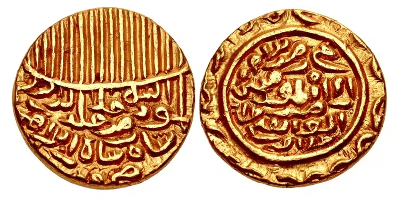
Ibrahim Shah was the first Jaunpur ruler identified as issuing coins in his own name. Known coins were struck in gold, silver, and copper. Mahmud Shah and Hussain Shah continued coin production in billon and copper. The inscriptions on Ibrahim Shah’s coins invoked the authority of the imam and described the ruler as deputy of the Commander of the Faithful, expressing the ideological language of Islamic sovereignty.
The military system also depended on the agrarian geography of the region. Rajput vassals are described as paying tribute through levies of peasant war-bands. This suggests that agricultural communities supplied manpower as well as revenue, although the surviving account does not provide detailed figures for taxation, crops, markets, or land assessment.
A contemporary account claims that Juga, a Bachgoti Rajput chief, assembled 200,000 infantry and 15,000 cavalry for Hussain Shah. The figures may be exaggerated, but they illustrate the scale attributed to the Rajput military support available to the Jaunpur ruler.
No securely documented maritime ports or overseas commercial networks are identified for the sultanate in the historical account. Jaunpur’s economic geography is best understood through its inland riverine and agrarian setting, coin circulation, tribute, and military mobilisation.
Cultural and Religious Geography
Jaunpur acquired a reputation as the “Shiraz of India” because of the patronage of learning under the Sharqi rulers. Ibrahim Shah established several colleges and encouraged the production of scholarly works on Islamic theology and law. Works associated with his reign include the Hashiah-i-Hindi, the Bahar-ul-Mawwaj, and the Fatwa-i-Ibrahim Shahi.
The city also developed a distinctive architectural tradition known as the Sharqi style. The Atala Masjid, the Lal Darwaza Masjid, the Jama Masjid, and the Jhanjhari Masjid are its best-known examples. The foundation of the Atala Masjid was laid under Firuz Shah Tughluq in 1376, but the building was completed during Ibrahim Shah’s reign in 1408. Ibrahim Shah built the Jhanjhari Masjid in 1430. The Lal Darwaza Masjid dates to 1450, during Mahmud Shah’s reign, while the Jama Masjid was built in 1470 under Hussain Shah.
Religious authority also influenced regional politics. Ibrahim Shah acted under the aegis of the Muslim holy man Nur Qutb Alam during his confrontation with the Bengal ruler Raja Ganesha. During Hussain Shah’s reign, Muhammad Jaunpuri, a claimant to be the mahdi of all Muslims, appeared; Hussain Shah was an admirer of him.
Hussain Shah also used the title Gandharva and is associated with the development of khayal, a genre of Hindustani classical music. Several ragas are attributed to him, including Malhar-shyama, Gaur-shyama, Bhopal-shyama, Hussaini or Jaunpuri-asavari, now known as Jaunpuri, and Jaunpuri-basant.
Military Geography
Jaunpur’s military geography was shaped by its position between Bihar, Bengal, the Doab, and Delhi. Malik Sarwar’s first campaigns secured Etawah, Koil, Kanauj, Kara, Awadh, Dalmau, Bahraich, and South Bihar. His forces also fought the Ujjainiyas of Bhojpur, whose later forest-based resistance demonstrated the difficulty of imposing authority over peripheral regions.
Ibrahim Shah expanded toward Bihar and Kanauj and marched against Delhi. His attempt to recover Kanauj in 1407 failed, as did his attempt to conquer Bengal. Mahmud Shah conquered Chunar but failed to capture Kalpi. His campaigns against Bengal and Odisha were also unsuccessful, and Odisha’s forces defeated the Jaunpur army decisively.
The final phase of the sultanate was dominated by war with Bahlul Lodi. Hussain Shah reached the banks of the Yamuna with a large army in 1478, rejecting Bahlul’s offer to retain Delhi as a vassal of Jaunpur. Bahlul crossed the river and defeated him. Hussain Shah later recaptured Etawah and again marched toward Delhi, but was defeated a second time.
In March 1479, Hussain Shah returned to the Yamuna and was defeated once more. Bahlul Lodi took the parganas of Kampil, Patiali, Shamsabad, Suket, Koil, Marhara, and Jalesar. Further battles at Senha, Rapri, and Raigaon Khaga preceded Hussain Shah’s final defeat on the banks of the Rahab. Bahlul appointed Mubarak Khan to Jaunpur, though Hussain Shah later expelled him and briefly reoccupied the capital.
Political Geography
Jaunpur’s neighbours included the Delhi Sultanate, Bengal, Odisha, regional Rajput chiefs, and the Ujjainiyas of Bhojpur. Its relations with these powers ranged from warfare to tributary recognition.
The Rai of Jajnagar and the ruler of Lakhnauti acknowledged Malik Sarwar’s authority and sent elephants. Ibrahim Shah threatened the Bengal Sultanate with the support of Nur Qutb Alam, but his attempt to conquer Bengal failed. Mahmud Shah’s campaigns against Odisha ended in defeat.
The western relationship with Delhi was more consistently confrontational. Tughlaq weakness enabled Jaunpur’s rise, but the Lodi dynasty rebuilt Delhi’s power. The Lodi-Sharqi wars transformed the map from one of Jaunpur’s expansion into one of progressive contraction.
Legacy and Decline
The independent Jaunpur Sultanate lasted from 1394 to 1494, although Sharqi authority continued in parts of Bihar after Hussain Shah lost the kingdom. The final Sharqi-dated inscriptions in Uttar Pradesh are recorded from 1476 at Kannauj and 1479 at Jaunpur, while Sharqi inscriptions in Bihar continued until 1505.
In 1486, Bahlul Lodi placed his eldest surviving son, Barbak Shah Lodi, on the throne of Jaunpur. Hussain Shah remained politically active after his expulsion, receiving asylum from Sultan Alauddin Husain Shah of Bengal and spending his final years at Kahalgaon. He died in 1505.
The Sharqi legacy survived in Jaunpur’s monuments, educational institutions, coinage, music, and regional political memory. The map’s shifting boundaries reflect more than the rise and fall of a dynasty: they show how control of the Gangetic plain depended on river crossings, military alliances, tribute, local chiefs, and the changing strength of Delhi.