Overview
At the edge of the creeks north of Mumbai lies Nallasopara, the modern city identified with ancient Sopara, or Shurparaka. In antiquity, this coastal settlement was a port of unusual reach. Literary and archaeological evidence connects it with maritime routes toward Sri Lanka, Arabia, eastern Africa, Mesopotamia, Egypt, Gujarat, and Malabar. Its position in the ancient region of Aparanta made it an important western gateway into the Indian subcontinent.
Sopara was more than a harbour. It was an important Buddhist centre, a place where a stupa preserved relic deposits, and a settlement associated with Ashokan inscriptions. It was also connected with the Satavahanas, under whom it functioned as an administrative unit. Buddhist, Hindu, Jain, and classical geographical traditions all remembered the town, though they preserved different aspects of its identity.
The ancient port does not survive as a single monumental city. Instead, its history is scattered across mounds, creek-side remains, inscriptions, coins, pottery, and literary references. These traces reveal a settlement whose fortunes rose and fell with maritime conditions, changing shorelines, and the shifting channels of coastal trade.
Etymology and Names
The modern name Nallasopara preserves the older name Sopara. Ancient Indian traditions refer to the town as Śūrpāraka or Shurparaka, while the Pali Buddhist form is Supparaka. The Greek geographer Ptolemy recorded it as Soupara. These related forms point to the long continuity of the place in regional and international accounts.
The Mahabharata and the Puranas associate Shurparaka with the legend of Parashurama reclaiming land from the sea. In this tradition, the reclaimed land became a dwelling place and the town became a tirtha, or sacred place. This is a religious account rather than a geological description, but it reflects the close relationship between Sopara and the sea in local memory.
Other traditions gave the town different associations. Jain writers connected Soparaka with the mythical king Shripala and with Tilakasundari, daughter of King Mahasena of Soparaka. In the fourteenth century, the Jain teacher Jinaprabhasuri listed Soparaka among eighty-four Jain tirthas and stated that an image of Rishabhadeva remained there in his time.
Geography and Location
Ancient Sopara stood on the coastal mainland in the area of present-day Nallasopara in Palghar district, Maharashtra. During the Early Historical period, the settlement faced Agashi island to the north and Bassein to the south. Backwaters between the mainland and the island created sheltered water suitable for the movement and anchorage of ships.
The ancient habitation site lies about two kilometres from the Buddhist stupa. The stupa overlooks a dry creek to the south, while the eastern side opens toward Thane Creek. Gass and Nirmal villages were once part of this creek landscape. Tanks, architectural fragments, and other remains have been identified in the areas adjoining them.
This geography shaped Sopara's commercial life. The harbour was not simply an open-sea landing place; creeks and backwaters offered protected access to vessels. The channel remained navigable into the nineteenth century, when ships of about twenty tonnes reportedly used it. At Bhatela Pond, a landing place or bunder, remains of a Portuguese jetty and customs house show that later maritime activity also occupied the same coastal environment.
Nallasopara has a tropical wet-and-dry climate. The south-west monsoon dominates the year, with the heaviest rains in July and more than eighty percent of annual rainfall falling between June and October. Average annual precipitation is about 2,434 millimetres, and humidity is high. Winters are comparatively cool, while summers are hot. Such seasonal conditions would have affected navigation, storage, travel, and the timing of coastal trade.
Ancient History
The earliest literary reference to Sopara occurs in the Mahabharata as Shuparak. More detailed maritime associations appear in the Supparaka Jataka, a Buddhist story generally regarded as belonging to around the sixth century BCE. It describes Sopara as a prosperous port whose skilled navigators travelled across seas linking western and southern Asian regions. The story presents these navigators as experts whose knowledge had exceptional value.
From approximately the third or fourth century BCE, the history of Sopara can be traced through more concrete evidence. The port's importance during the Mauryan age is demonstrated by fragments of Ashoka's eighth and ninth major rock edicts discovered near an old Muslim graveyard by Ramkund. A fragment of the eleventh major rock edict was later found at the coastal village of Bhuigaon.
The Pali Mahavamsa states that Vijaya, described as the first king of the Sinhalese kingdom, sailed from Supparaka to Sri Lanka. The account is part of a traditional narrative, but it preserves the memory of Sopara as a port connected with voyages across the Arabian Sea and the waters around the island.
Ptolemy later mentioned Soupara as a major commercial centre. Literary memory and archaeological material together indicate that Sopara was a major entrepôt from the pre-Ashokan period into the early centuries of the Common Era. Its trade was not restricted to a single route. The archaeological record includes materials associated with local and long-distance exchange.
Archaeological Evidence
The first major modern excavation at Sopara took place in April 1882, when Bhagvanlal Indraji excavated the Burud Rajache Kot mound at Merdes village. The remains of a Buddhist stupa were found. At the centre of the stupa, inside a brick-built chamber, archaeologists discovered a large stone coffer.
The coffer contained eight bronze images of Maitreya Buddha, dated to approximately the eighth or ninth century CE. It also held relic caskets made of copper, silver, stone, crystal, and gold, together with numerous gold flowers and fragments of a begging bowl. A silver coin of the Satavahana ruler Gautamiputra Satakarni was found at the mound as well.
The discoveries were transferred to the Asiatic Society of Bombay by the Bombay Provincial Government. Coins and artefacts from the excavations remain viewable in the Asiatic Society of Mumbai museum. The Ashokan fragments are held at the Chhatrapati Shivaji Maharaj Vastu Sangrahalaya in Mumbai.
The site was examined again in 1939–1940 by M. M. Qureshi of the Archaeological Survey of India. This work uncovered several stone lintels and two small stupas south of the main stupa. It also produced sherds of plain glazed ware associated with the Muslim period. Further discoveries followed: Satavahana lead coins were reported in 1972, and the 1993 excavations found a ring well, Roman amphora fragments, Red Polished Ware, and glass from the early centuries of the Common Era.
A joint excavation by the Archaeological Survey of India and the British Academy in 1993 recovered lead and copper coins, semi-precious stone beads, fragments of Northern Black Polished Ware, amphora pieces, and Islamic blue glazed ware. Archaeologists also encountered an earthen wall and a substantial stone wall made from blocks of varying sizes. These materials show that Sopara participated in networks that carried both Indian and overseas goods.
Historical Timeline
Mauryan Period
Ashoka's rock-edict fragments establish Sopara's importance during the third century BCE. The inscriptions refer to Ashoka using the titles Devanampiya, “Beloved of the Gods,” and Piyadassi. Although the surviving fragments do not provide a complete account of Sopara's administration, their presence places the port within the wider landscape of Mauryan imperial communication and moral proclamation.
Satavahana Period
Sopara became one of the administrative units under the Satavahanas. Coins associated with the dynasty, including a silver coin of Gautamiputra Satakarni and other Satavahana lead coins, were found at the site. References to Sopara also occur in inscriptions at Karle, Nashik, Naneghat, and Kanheri, linking the port with the wider political and religious networks of western India.
Later Historical and Medieval Periods
The archaeological sequence suggests that Sopara was a principal entrepôt from before Ashoka until about the third century CE. The evidence becomes less continuous between the fourth and ninth centuries, although the stupa's relic deposit contains material dated to the eighth or ninth century. From approximately the ninth to the thirteenth centuries, the settlement again appears important in the archaeological record.
Islamic glazed ware from the habitation site shows that the settlement remained connected to later commercial worlds. Jain literary references also preserve its religious status. By the nineteenth century, the creek was still navigable, and later Portuguese structures at Bhatela Pond indicate the persistence of maritime activity in the broader landscape.
Political Significance
Sopara's political value arose from its position as a port and administrative centre. Under the Satavahanas, it formed part of a larger system of western Indian governance. Its mention in inscriptions at Karle, Nashik, Naneghat, and Kanheri suggests that it was connected to routes carrying officials, merchants, religious communities, and goods between the coast and the interior.
The Ashokan inscriptions add an earlier imperial dimension. Sopara was not merely a local harbour; it was important enough to receive inscriptions associated with one of the most expansive political powers of ancient India.
Religious and Cultural Importance
Buddhism shaped Sopara's identity for many centuries. The Supparaka Jataka presents its navigators as figures of exceptional maritime knowledge, while the excavated stupa demonstrates the presence of an organised Buddhist religious establishment. Relics, stupas, images, inscriptions, and votive objects show that religious activity was closely connected with the port's urban and commercial life.
The town also retained importance in Hindu and Jain traditions. The Shurparaka legend links it to Parashurama and the reclamation of land from the sea. Jinaprabhasuri's account identifies Soparaka as a Jain tirtha and mentions an image of Rishabhadeva.
In the modern city, the Chakreshwar Mahadev Mandir stands beside Chakreshwar Lake in Nallasopara West. It is associated with Swami Samarth, who is said to have meditated there, established a nearby Ram temple, and blessed a disciple who undertook a living samadhi at the site.
Economic Role
Sopara's economy depended on its harbour, its creek system, and its position on western maritime routes. Literary accounts describe trade with ports in Southwest Asia, Gujarat, Malabar, and Sri Lanka. Other traditions and historical summaries connect the town with Mesopotamia, Egypt, Arabia, eastern Africa, and Cochin.
Archaeological finds give material form to these connections. Roman amphora fragments, glass, Red Polished Ware, beads, and coins indicate the movement of goods and people across coastal and overseas networks. The presence of Islamic glazed ware at the habitation site demonstrates that long-distance exchange continued in later periods.
Decline and Revival
Sopara's fortunes were closely tied to the coastline. Archaeological interpretations identify siltation, together with a rise in sea level, as a major cause of the ancient port's decline. As channels changed and harbour access became more difficult, the settlement lost some of its earlier commercial importance.
The evidence is not uniform across the centuries. Material remains are sparse for part of the fourth to ninth centuries, while later finds show renewed activity. The ancient port's full extent remains uncertain, and further onshore and offshore marine archaeology would be needed to establish how far the harbour and urban settlement extended.
Modern City
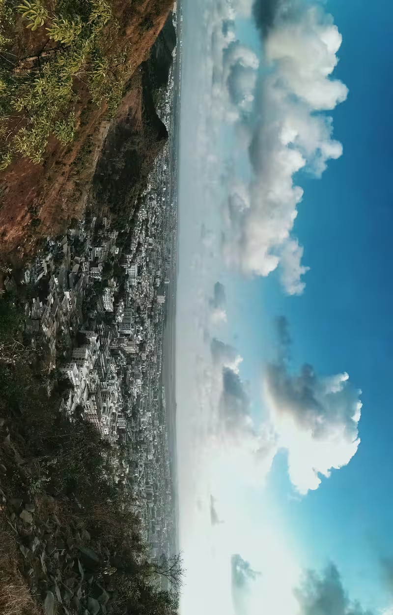
Today, Nallasopara is governed by the Vasai-Virar Municipal Corporation and lies within the Mumbai Metropolitan Region. Its railway station belongs to the Western Railway Zone, and the city falls under the Mira-Bhayander, Vasai-Virar Police Commissionerate.
The 2001 census recorded a population of 184,664. Gujarati, Urdu, and Hindi are among the minority languages spoken in the city. Nallasopara's modern urban character sits above a layered coastal history: Buddhist remains, Ashokan inscriptions, Satavahana coins, medieval wares, Portuguese maritime structures, and living religious sites all belong to the same broad landscape.