Karkota Dynasty Territories, c. 625–855 CE
Introduction
The Karkota dynasty emerged in Kashmir during the seventh century and made the Kashmir valley the centre of a powerful political, religious, and cultural state. Its rulers governed Kashmir from approximately 625 to 855 CE, while historical accounts also associate them with territories in Punjab, Khyber Pakhtunkhwa, and other northern parts of the Indian subcontinent. The map therefore distinguishes the dynasty’s Kashmir heartland from wider territorial claims whose exact boundaries and political status remain uncertain.
The Karkota period is especially associated with Durlabhavardhana, Durlabhaka, Candrapida, Tarapida, Lalitaditya Muktapida, and Jayapida. Under these rulers, Kashmir experienced political expansion, active diplomacy, temple and monastery construction, monetary circulation, and the development of a distinctive artistic and literary culture. Lalitaditya’s reign is traditionally presented as the high point of Karkota expansion, although the scale of his conquests is one of the most debated aspects of early medieval Kashmiri history.
The dynasty ended in the mid-ninth century after a period of succession struggles and factional conflict. In approximately 855 CE, Avantivarman, supported by the minister Sura, deposed the Karkota ruler Utpalapida and founded the Utpala dynasty. The map consequently represents not a single fixed imperial boundary, but the changing political geography of a Kashmir-centred dynasty over more than two centuries.
Historical Context
The establishment of the Karkotas followed the period of Huna influence in Kashmir. The precise circumstances remain disputed. Kalhana’s Rajatarangini, an eleventh-century Sanskrit chronicle, presents Durlabhavardhana as a subordinate associated with the earlier Gonanda line. In that account, he married Anaṅgalekhā, the daughter of Baladitya, and later obtained the throne with ministerial support. He also claimed descent from the mythical Naga king Karkotaka.
This account cannot be accepted without qualification. The early books of the Rajatarangini compress and rearrange names, assign unusually long reigns, and combine traditions from different periods. Atreyi Biswas proposed a different reconstruction in which Durlabhaka Pratapaditya, rather than Durlabhavardhana, was the first Karkota ruler and gained power after defeating Yudhisthira, described in that interpretation as the last Alchon Hun ruler of Kashmir. Other scholars have disputed aspects of this chronology, particularly the dating of Narendraditya Khinkhila. The map therefore presents the dynasty’s beginnings as historically significant but not fully settled.
Durlabhavardhana is assigned a reign from approximately 625 to 661 or 662 CE. The Rajatarangini records no major military campaigns under him, but accounts associated with the Chinese pilgrim Xuanzang have been used to suggest that his authority extended beyond the immediate Kashmir valley. These reports have been interpreted as placing Kashmir, parts of Punjab, and Khyber Pakhtunkhwa within his sphere of control. The exact relationship between these regions and the Karkota court is not clear.
Durlabhaka, also called Pratapaditya, is assigned a reign from approximately 662 to 712 CE. During his rule, relations with neighbouring polities became more active, and the Classical Kārkoṭa style of sculpture developed. The foundation of Pratāpapura, identified with present-day Tapar between Baramula and Srinagar, is attributed to him. His reign also saw the establishment of agraharas, or endowed settlements associated with Brahmin beneficiaries.
Candrapida ruled approximately from 712 or 713 to 720 CE. He is also known as Vajraditya and appears in Tang records under the name Zhentuoluobili. In 713, he sent an embassy to the Tang emperor Xuanzong seeking assistance against Arab invasions. The Tang court did not provide the requested military aid, but Candrapida is said to have defended his territory. In 720, the Tang emperor sent an envoy who bestowed on him the title “King of Kashmir.”
These exchanges created a durable diplomatic connection between Kashmir and the Tang court. In 722, after Tang forces defeated Tibet, Chinese records credited Kashmir with supplying food to Tang troops stationed in Gilgit. This evidence places Kashmir within the strategic politics of the north-western Himalayan region, even though it does not establish a precisely mapped frontier.
Tarapida succeeded Candrapida and ruled for approximately four years. His reign is described as tyrannical in the Rajatarangini. Chinese records from October or November 724 mention a king of Kashmir who responded to a request for defection from Jincheng and sought assistance from Zabulistan against Tibetan forces. Some scholars identify this ruler as Tarapida, while others associate the episode with Candrapida. The map treats this identification as uncertain.
Lalitaditya Muktapida ruled approximately from 724 or 725 to 760 or 761 CE. He is the most important ruler in accounts of Karkota territorial expansion. Kalhana portrays him as a world conqueror whose campaigns reached across much of India, Afghanistan, and Central Asia. He is also credited with defeating Yashovarman of Kannauj. Yet Kalhana wrote roughly four centuries after Lalitaditya’s reign, and later political and cultural memory may have magnified his achievements.
The debate over Lalitaditya’s conquests is central to interpreting the map. Marc Aurel Stein regarded the expansive account as largely legendary, while Hermann Goetz accepted much of it as historical. Later scholars have continued to disagree. A comparison of Kalhana’s narrative with Chinese and Tibetan records, coins, and pilgrimage accounts has led some historians to reject the largest claims. The map therefore marks Kashmir as the secure political centre and presents distant conquests as reported or contested rather than as undisputed permanent provinces.
After Lalitaditya, the dynasty entered a period of succession disputes. Kuvalayapida, his son by Kamaladevi, ruled for approximately one year and one month. He competed with his half-brother for power and later abdicated. Vajraditya, the son of Lalitaditya and Chakramardika, ruled for approximately seven years and is described by Kalhana as a cruel ruler. His reign is also associated with a raid by the governor of Sindh and the introduction of slave trading.
Prithivyapida I ruled for approximately four years and one month before being overthrown by Samgramapida I, whose reign lasted only seven days. Tribhuvanapida, although the eldest son of Vajraditya, had previously abdicated. These brief reigns indicate the instability of dynastic succession after Lalitaditya.
Jayapida, also known as Vinayaditya, ruled for approximately thirty-one years. Like Lalitaditya, he is associated with distant campaigns, but the Rajatarangini’s account is considered exaggerated and lacks sufficient corroboration from other regions. Jayapida established Jayapura, identified with present-day Andrkoth, and patronised Buddhist viharas and Buddha images. His court also became an important centre of literary theory and poetry.
The later Karkota rulers exercised increasingly fragile authority. Lalitapida ruled for twelve years, while Samgramapida II, also known as Prithivyapida II, ruled for seven. Cippatajayapida was crowned in approximately 837 or 838, but because of his youth, actual power rested with the five brothers of his mother Jayadevi: Padma, Utpala, Kalyana, Mamma, and Dharma.
Cippatajayapida was murdered around 840 after ruling for approximately twelve years. The five brothers then competed for control while installing puppet rulers from the Karkota lineage. Ajitapida, Anangipida, and Utpalapida were successively placed on the throne. Under Utpalapida, merchants declared independence at outposts of the territory. Sukhavarman later attempted to assume the throne but was murdered. His son Avantivarman eventually deposed Utpalapida around 855 CE and established the Utpala dynasty.
Territorial Extent and Boundaries
The Kashmir valley formed the Karkota heartland. It was the dynasty’s political centre, the location of its principal courts and religious foundations, and the setting for the cultural developments associated with the period. The valley’s surrounding mountain terrain gave Kashmir a distinct geographical identity while also connecting it to the Punjab plains, the north-western highlands, and routes toward the trans-Himalayan world.
The northern reach of Karkota authority is associated with regions connected to Gilgit and Khyber Pakhtunkhwa. The account of Tang troops receiving supplies from Kashmir in 722 demonstrates that Kashmir was linked to the north-western military zone, but it does not by itself prove that every intervening area was directly administered by the Karkota court. The map consequently uses a distinction between core territory and reported wider influence.
The southern and south-western extent is connected in historical accounts with Punjab and, in the most expansive interpretations of Lalitaditya’s campaigns, with Kannauj and other parts of northern India. These claims must be treated differently. Durlabhavardhana’s authority over parts of Punjab is inferred from interpretations of Xuanzang’s accounts, while Lalitaditya’s conquest of Yashovarman is preserved in Kalhana’s narrative. Neither provides a simple administrative boundary comparable to a modern state border.
The eastern and north-eastern political environment included Tibet and Tang-controlled territories. Kashmir’s relations with the Tang court were shaped by conflict involving Tibet and by the strategic importance of Gilgit. These relationships demonstrate the dynasty’s participation in wider Himalayan politics, but they do not indicate that Tang or Tibetan territories formed part of the Karkota kingdom.
The western political horizon included the regions of Sindh, Zabulistan, and the north-western routes beyond Kashmir. A successful raid by the governor of Sindh is associated with Vajraditya’s reign. The possible appeal to Zabulistan during the crisis involving Tibetan troops shows the importance of alliances and military contacts beyond the valley. The available record does not establish a stable Karkota western frontier.
No securely documented provincial boundary survives for the dynasty. The distinction between direct rule, military influence, temporary conquest, diplomatic recognition, and supply relationships is essential. The map therefore avoids presenting every place named in literary accounts as a permanently incorporated territory.
Administrative Structure
Karkota administration was centred on the king and his court. The surviving record names ministers, royal relatives, Brahmin beneficiaries, merchants, and powerful military or political factions, but it does not preserve a complete administrative division of the kingdom.
The grant of agraharas was an important feature of royal policy. Durlabhavardhana is said to have donated many villages to Brahmins, while Durlabhaka’s reign saw further settlements established by Hanumant, the son of his minister Uda. Jayapida later attempted to rescind agraharas and imposed heavy taxation on Brahmins, contributing in Kalhana’s account to the emigration of some beneficiaries. These details suggest that land grants connected the court to local elites and religious communities.
The foundation of towns and shrines also helped express royal authority. Durlabhaka established Pratāpapura. Jayapida founded Jayapura and Lalitaditya established Parihasapura as a new capital. These foundations were not merely urban settlements: they were also political statements that associated kingship with temples, monasteries, patronage, and the remaking of the Kashmiri landscape.
The late dynasty reveals the limits of central control. After Cippatajayapida’s murder, the five brothers of Jayadevi exercised power through puppet monarchs. Merchants at territorial outposts declared independence during Utpalapida’s reign. This indicates that distant centres could act independently when royal authority weakened, although the precise location of these outposts is not preserved.
Infrastructure and Communications
The historical record does not provide a detailed inventory of Karkota roads, bridges, postal stations, or formal communication systems. Nevertheless, diplomatic and military events demonstrate that Kashmir was connected to a wider network of movement.
The embassies exchanged between Candrapida and the Tang court in 713 and 720 required communication across difficult northern routes. The reference to Tang troops stationed in Gilgit and supplied by Kashmir in 722 further indicates the existence of practical connections between the valley and the north-western Himalayan zone. These links may have combined mountain passages, valley routes, and military supply lines, but their exact courses are not recorded here.
The movement of Brahmin immigrants from the Indus and Dravida regions into Kashmir during Jayapida’s reign also demonstrates long-distance mobility. Scholars, poets, religious specialists, and court officials travelled to and from Kashmir. Jayapida and Lalitaditya are both associated with inviting intellectuals from outside the valley.
There is no evidence in the record for Karkota maritime power. The dynasty’s strategic geography was continental and mountain-oriented, focused on Kashmir, the Punjab, the north-west, Central Asia, and the Himalayan frontier.
Economic Geography
Karkota economic life included agriculture, land grants, taxation, trade, and monetary circulation. Metallic coins were used alongside cowrie shells. Coins issued by major rulers until Muktapida and Jayapida have been excavated, and these coins carried the name of Kidara on the reverse. Their circulation provides material evidence for royal authority and monetary practice, even though the surviving information does not permit a complete reconstruction of mints or commercial zones.
Trade relations with neighbouring polities increased during Durlabhaka’s reign. Merchant communities appear prominently in accounts of Kashmiri society, and the Kuttanimata presents a social world in which merchants exercised considerable influence. Under the later puppet kings, merchants at outposts declared independence, showing that commercial communities could become politically significant when central authority declined.
The state collected several forms of revenue, including customs levies, market taxes, and a tax connected with prostitution. Damodaragupta’s writings refer critically to corruption. These references suggest that taxation operated across urban and commercial settings, although no complete schedule or territorial distribution of taxes is known.
The valley’s agricultural capacity was politically important. Kashmir’s ability to supply Tang troops in Gilgit in 722 demonstrates the use of its resources beyond the immediate royal centre. The historical record, however, does not provide figures for population, crop production, or the volume of trade. No securely documented list of major ports exists, and the dynasty should not be represented as a maritime power.
Cultural and Religious Geography
Karkota religious geography was plural and changing. The rulers constructed shrines to Vishnu, while Buddhism continued to flourish. The ruins associated with the dynasty’s capital included stupas, chaityas, and viharas. This combination of Hindu and Buddhist institutions indicates a syncretic religious environment rather than a simple replacement of one tradition by another.
Durlabhavardhana established the Vishnu shrine of Durlabhasvāmin at Srinagar. His wife founded the Buddhist monastery of Anangabhavana. He is also associated with architectural styles influenced by post-Gupta developments at Sarnath and Nalanda. These connections place Kashmir within broader artistic and religious currents of northern South Asia.
Durlabhaka founded the shrine of Malhanasvāmin, while his wife established the Narendreśvara Temple. Candrapida is associated with several Vishnu shrines. Jayapida founded Buddhist viharas and commissioned Buddha images. These foundations show that religious patronage extended across different communities and was used by rulers to shape urban and dynastic landscapes.
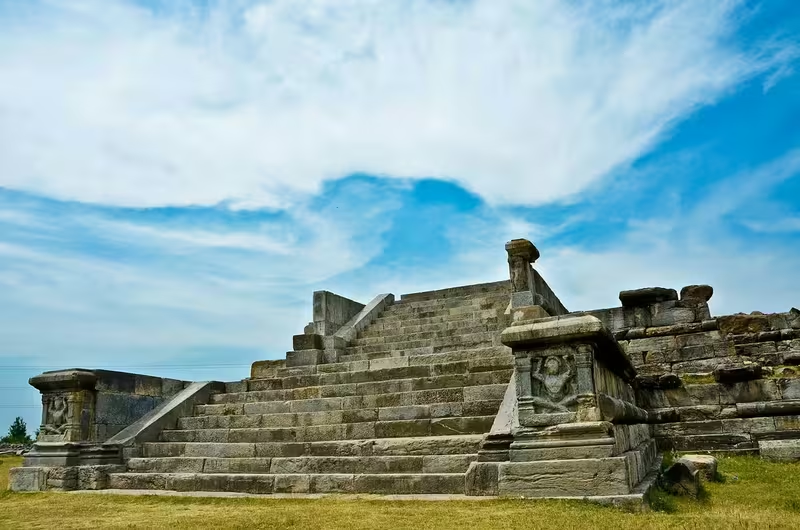
Lalitaditya commissioned numerous temples and Buddhist structures. His most celebrated monument is the Martand Sun Temple in present-day Anantnag district. It is described as the oldest known Sun temple in India and as one of the largest temple complexes of its time. The monument represents both the prominence of solar worship and the scale of royal architectural patronage during Lalitaditya’s reign.
Lalitaditya’s period is also regarded as the zenith of Kashmiri sculpture. The record mentions bronze images, gold and silver images commissioned for temples and monasteries, terracotta works, and stone sculptures associated with Durlabhaka. These works reflect the participation of both Hindu and Buddhist institutions in the artistic culture of the dynasty.
Karkota Kashmir was also a major literary centre. The Nilamata Purana, believed to have been commissioned by Durlabhavardhana, presents Kashmir as a sacred landscape and legitimises the ruler’s position within that religious geography. Because the text contains later interpolations and ideological construction, it must be read critically rather than treated as a neutral chronicle. The Vishnudharmottara Purana represents another local work associated with the period.
Jayapida’s court became particularly important for literary criticism. Vāmana served as a minister, while Udbhaṭa was chief scholar. Their works addressed poetic theory, aesthetics, semantic cognition, and literary practice. The court also included the grammarian Kṣīra, poets such as Manoratha and Śaṅkhadatta, and the Buddhist philosopher Dharmottara.
Damodaragupta composed the Kuttanimata, a didactic work on erotics that also provides a vivid picture of Kashmiri social life. Ratnākara wrote the Haravijaya under Cippatajayapida’s patronage. The poem, in fifty cantos and 4,351 verses, recounts the defeat of Andhaka by Shiva and is described as the largest surviving Mahākāvya.
Military Geography
Karkota military geography was shaped by the position of Kashmir between the Himalayan interior, the Punjab, the north-western uplands, and the routes toward Central Asia. The valley served as the dynasty’s political base, while the surrounding passes and frontier zones connected it to competing powers.
Candrapida’s appeal to Tang China in 713 was made in response to Arab invasions. Although Tang military assistance did not arrive, Candrapida successfully defended his territory. The episode shows that Kashmir’s rulers viewed diplomacy as part of frontier defence.
The later exchange involving Tibet and Zabulistan reveals a second strategic environment. A king of Kashmir, identified by some scholars as Tarapida and by others as Candrapida, considered supporting a defector from the Tang sphere and sought military assistance from Zabulistan against Tibetan forces. The identification remains uncertain, but the event illustrates the complexity of north-western alliances.
Lalitaditya’s reported campaigns are central to the dynasty’s military reputation. Kalhana describes conquests across India, Afghanistan, and Central Asia, including the defeat of Yashovarman of Kannauj. Yet the absence of adequate corroborating evidence across such a wide area has led several historians to question the narrative. The map presents these campaigns as reported claims rather than uncontested territorial acquisitions.
The record does not preserve the size or organisation of Karkota armies. Nor does it identify a complete network of fortresses or garrisons. Military power appears to have depended on the king, ministers, regional forces, diplomatic alliances, and control of movement through the mountain-connected landscape.
Political Geography
Karkota diplomacy extended beyond Kashmir. The relationship with Tang China is the clearest documented connection. Candrapida’s embassies, the Tang title granted to him in 720, and the later recognition of Kashmiri assistance to Tang forces in Gilgit all indicate formal interaction between the two courts.
Relations with Tibet were more conflictual. Tibetan forces appear in the accounts of the north-western crisis during the 720s, and the Tang victory over Tibet in 722 formed the background to the recognition of Kashmiri logistical support. These events placed the Karkota kingdom within a three-way strategic environment involving Kashmir, Tibet, and Tang China.
The dynasty also interacted with Sindh and Zabulistan. The raid by the governor of Sindh during Vajraditya’s reign suggests hostility or competition across the western frontier. The proposed military cooperation with Zabulistan shows that Kashmir could seek partners beyond the immediate Himalayan region.
Within northern India, the claimed confrontation with Yashovarman of Kannauj is one of the most famous episodes associated with Lalitaditya. Its historical scale is debated, and the political relationship between Kashmir and Kannauj cannot be reduced to a permanently annexed territory based on the literary account alone.
Legacy and Decline
The Karkota dynasty lasted from approximately 625 to 855 CE. Its most durable legacy lies not only in territorial claims but also in the transformation of Kashmir into a centre of religious patronage, sculpture, architecture, and scholarship.
The dynasty’s political structure weakened after Lalitaditya. Short reigns, rival branches of the royal family, ministerial intervention, and the growing power of court factions destabilised the throne. The conflict among the five brothers of Jayadevi created a sequence of puppet kings. The independence of merchants at outposts further demonstrated the erosion of central authority.
Avantivarman’s accession around 855 ended Karkota rule and inaugurated the Utpala dynasty. The transition did not erase the institutions or cultural traditions established under the Karkotas. Temples, monasteries, towns, literary works, sculptures, and royal foundations continued to shape the historical identity of Kashmir.
The map’s most important distinction is between the secure Kashmir-centred kingdom and the broader imperial image preserved in later historical writing. Karkota power unquestionably operated from Kashmir and maintained significant northern connections. The precise extent of direct rule beyond the valley, especially during Lalitaditya’s reign, remains a matter of scholarly debate. Reading the map alongside the Rajatarangini, Tang records, coins, pilgrim accounts, inscriptions, and archaeological remains reveals a dynasty whose influence was substantial, but whose outer boundaries cannot always be drawn with certainty.