Overview
On the southern bank of the Krishna River, Amaravati preserves a historical landscape shaped by both Buddhist and Hindu traditions. The village lies near Dhanyakataka, identified with modern Dharanikota, which served as the eastern capital of the Satavahana dynasty. Its best-known monument is the Amaravati Stupa, also called the Mahachaitya, whose construction and rebuilding extended from the late centuries BCE into the early centuries CE.
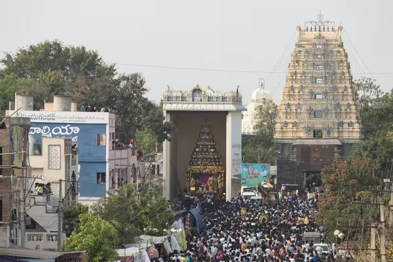
Amaravati is also home to the Amareswara Temple, one of the Pancharama Kshetras, a group of important Shaiva temples in Andhra Pradesh. The coexistence of the Buddhist stupa, the Hindu temple, later settlements, museums, and modern Buddhist landmarks gives the place an unusually layered character. The village now serves as the administrative centre of Amaravati mandal and falls within the Andhra Pradesh Capital Region. It lends its name to the separately planned capital city located about 35 kilometres to the east in Guntur district.
The ancient remains are especially important for the history of Buddhist art. Sculptures from Amaravati helped establish a distinctive artistic tradition known as the Amaravati School or Andhra School of Art. Works associated with this tradition are preserved not only in India but also in collections such as the British Museum in London.
Etymology and Names
The name Amaravati is translated as “The Abode of Immortals.” It is connected with the Amareswara Temple, whose deity is Lord Shiva. The temple's religious importance made Amaravati a recognised pilgrimage centre, while the nearby ancient settlement of Dhanyakataka gave the area a second historical identity.
Dhanyakataka was the capital associated with the eastern branch of Satavahana power. The name is often connected with modern Dharanikota, situated close to Amaravati. In historical writing, therefore, Amaravati and Dhanyakataka may appear together, although the village and the ancient capital are not identical sites.
Geography and Location
Amaravati is located at 16.579444° north and 80.311111° east in present-day Palnadu district, Andhra Pradesh. The village covers approximately 1,524 hectares, or 15.24 square kilometres. Its position beside the Krishna River helped place it within an important cultural landscape of the Andhra region.
The riverbank setting shaped both settlement and connectivity. In the present day, roads link Amaravati with Vijayawada, Guntur, Tenali, Mangalagiri, Sattenapalle, and Krosuru. The Vijayawada–Amaravati Road also connects the village with settlements within the Andhra Pradesh Capital Region. Amaravati has no railway station or rail connectivity. Bus services operated by the Andhra Pradesh State Road Transport Corporation connect it with major bus stations in Guntur, Vijayawada, and Tenali.
Ancient History
Amaravati's historical landscape is traditionally associated with events in the Buddhist past. According to the tradition of the Kalachakra Tantra, Gautama Buddha visited the Andhaka region, identified with the area around Dhanyakataka, and delivered sermons there. This association belongs to Buddhist tradition rather than to a securely dated archaeological event.
During the Mauryan period, the region remained on the periphery of the empire. A major change came with the rise of the Satavahana dynasty around 225 BCE. Dhanyakataka became the dynasty's eastern capital, while Pratisthana, identified with modern Paithan, served as its western capital. The area's position near the Krishna River and its connections to wider networks helped it develop into a major centre of religious activity.
The Amaravati Stupa probably originated in the post-Mauryan period, around 200–100 BCE, although its building history is complex. The monument was constructed and enlarged in several phases, with later additions and renovations continuing until around 250 CE. Sculptural components were sometimes reused, showing that the monument changed substantially over time rather than being created in a single building campaign.
The Satavahana period saw the growth of a distinctive artistic style at Amaravati and Sannati in present-day Karnataka. Amaravati sculptures are known for intricate detail and for their treatment of Buddhist subjects. Images and narrative scenes included the Vajrasana, Muchulinda Naga, episodes from the life of the Buddha, and memorial stones. Artistic works made in this tradition were exported to Sri Lanka, where they contributed to the wider spread of Buddhist visual culture.
Amaravati's monasteries and educational institutions attracted scholars from different parts of India as well as from East and Southeast Asia. After the Satavahanas declined, the Ikshvaku dynasty continued to support Buddhist institutions in the region during the third and fourth centuries CE. The Buddhist history of Amaravati was therefore sustained across more than one dynasty.
Historical Timeline
Mauryan and Satavahana Periods
The region around Amaravati remained connected to the Mauryan world without being described as a central Mauryan capital. Around 225 BCE, the Satavahanas emerged as a major power, and nearby Dhanyakataka became their eastern capital. The stupa's earliest phase is generally placed after the Mauryan period, around 200–100 BCE.
Around 50 CE, the Satavahanas added new sculptures and expanded the monument. These changes helped produce the artistic form for which Amaravati became known. The stupa and the surrounding Buddhist institutions continued to develop into the early centuries CE.
Ikshvaku and Later Ancient Period
The Ikshvakus ruled the region in the third and fourth centuries CE. Their patronage helped Buddhist monasteries and educational institutions continue after Satavahana power weakened. Amaravati's artistic influence also extended beyond the Krishna valley, especially through the circulation of sculptures and visual ideas to Sri Lanka and Southeast Asia.
The Skanda Purana later preserved accounts of Amaravati's religious importance, with particular attention to the Shiva temple. These traditions contributed to the continuing sacred identity of the settlement.
Late 18th Century and Archaeological Recognition
Amaravati took a new form in the late eighteenth century under the zamindar Vasireddy Venkatadri Nayudu. He moved his seat of power from Chintapalli to Amaravati and invited settlers from surrounding areas to establish a new township. Support was provided for construction, and the settlement expanded beside the ancient remains.
The Buddhist stupa, known locally as Dipaladinne, or “Hill of Lamps,” was recognised as an archaeological mound by Colonel Colin Mackenzie in 1797. Before that recognition, the mound was excavated on Venkatadri Nayudu's orders in the hope of finding valuables. The excavators found no treasure, but they did uncover large bricks and sculptured marble slabs.
Some of these materials were reused in local construction, including the Sivaganga tank. Certain sculpted slabs were defaced before being used in local mosques, reportedly to prevent their association with idolatry. Mackenzie returned in 1818 with a team that prepared detailed drawings and recovered sculptural pieces. Later, Walter Elliot excavated further and sent a substantial group of artefacts, now known as the “Elliot Marbles,” to the British Museum.
Political Significance
Amaravati's political importance is closely linked to nearby Dhanyakataka rather than to a continuous role as a capital in its own right. Dhanyakataka's position as the eastern capital of the Satavahanas placed the surrounding area within a major dynastic centre. The region remained an important setting for institutions supported by successive powers, including the Ikshvakus.
In the late eighteenth century, Amaravati became the seat of Vasireddy Venkatadri Nayudu's authority. His decision to move there transformed the village's physical form and brought a new phase of settlement. Today, Amaravati is the administrative centre of Amaravati mandal and forms part of the Andhra Pradesh Capital Region. Its historical name has also been adopted by the state's planned capital located to the east, creating a modern political association distinct from the heritage village.
Religious and Cultural Importance
Amaravati is a pilgrimage centre for both Hindus and Buddhists. The Amareswara Temple gives the village its name and remains central to its Hindu identity. Inscriptions on the temple walls record the reign of Vasireddy Venkatadri Nayudu, who was associated with the construction of temples and educational institutions in the Krishna River delta.
For Buddhists, the Amaravati Stupa is the defining monument. The Mahachaitya and its surrounding ruins are centrally protected Monuments of National Importance under the Archaeological Survey of India. In 2006, the Dalai Lama visited Amaravati and performed the Kalachakra Mahasamalanam during the Kalachakra festival. The 30th Kalachakra festival was held there in the first week of January that year.
The modern 125-foot Dhyana Buddha statue gives visible form to Amaravati's continuing Buddhist identity. The Amaravati Heritage Centre and Museum, formerly known as the Kalachakra Museum, preserves artefacts, replicas, and displays related to the area's ancient past.
Monuments and Architecture
The Amaravati Stupa was built in phases between the third century BCE and approximately 250 CE. Its architectural history includes early construction, later enlargement, and the addition or replacement of sculptural elements. The surviving ruins and dispersed sculptures reveal the scale and artistic ambition of the original monument.
The Amaravati School of Art is characterised by detailed carving and Buddhist narrative imagery. Its works are often discussed alongside the Mathura and Gandhara schools as one of the major traditions of ancient Indian Buddhist art. Unlike a single isolated style, it represents a long artistic development connected to changing architectural phases at the stupa and other regional sites.
The Amareswara Temple represents a different but equally important strand of the area's heritage. Together with the Buddhist ruins, it demonstrates how Amaravati's sacred geography developed through multiple religious traditions.
Famous Personalities
Vasireddy Venkatadri Nayudu shaped the modern settlement by moving his seat to Amaravati and encouraging construction. His rule is recorded in the inscriptions of the Amareswara Temple.
Colonel Colin Mackenzie played an important role in the early archaeological recognition of the stupa, first identifying its significance in 1797 and returning in 1818 to document and recover sculptures. Walter Elliot later excavated the site, and the artefacts associated with his work became known as the Elliot Marbles.
Decline and Revival
The decline of the Satavahanas did not end Amaravati's religious importance, since the Ikshvakus continued to support Buddhist institutions. Over later centuries, however, the ancient monument became a mound whose materials were reused in local construction. Its archaeological importance was gradually recovered through the work of Mackenzie, Elliot, and later preservation efforts.
Today the Archaeological Survey of India protects the stupa site, while the heritage centre and museum support interpretation and conservation. Amaravati has also been recognised under the Heritage City Development and Augmentation Yojana, linking its preservation to a broader heritage-development programme.
Modern City
According to the 2011 Census of India, Amaravati had approximately 13,400 residents in 3,316 households. The population included 6,432 males and 6,958 females, giving a sex ratio of 1,082 females per 1,000 males. The recorded literacy rate was 71.3 percent.
The village has 17 schools: four MPP schools, one KGBV school, and twelve private schools, according to the 2018–19 school information report. Its local government is the Amaravati gram panchayat, divided into wards represented by ward members.
Visitors reach Amaravati primarily by road. A proposed class-III waterway from Pulichintala to Prakasam Barrage is intended to connect nearby villages, including Harishchandrapuram and Vykuntapuram. The village's strongest attractions remain its protected Buddhist ruins, Amareswara Temple, museums, and Dhyana Buddha statue.